/ Tanjung Bawang Landscape
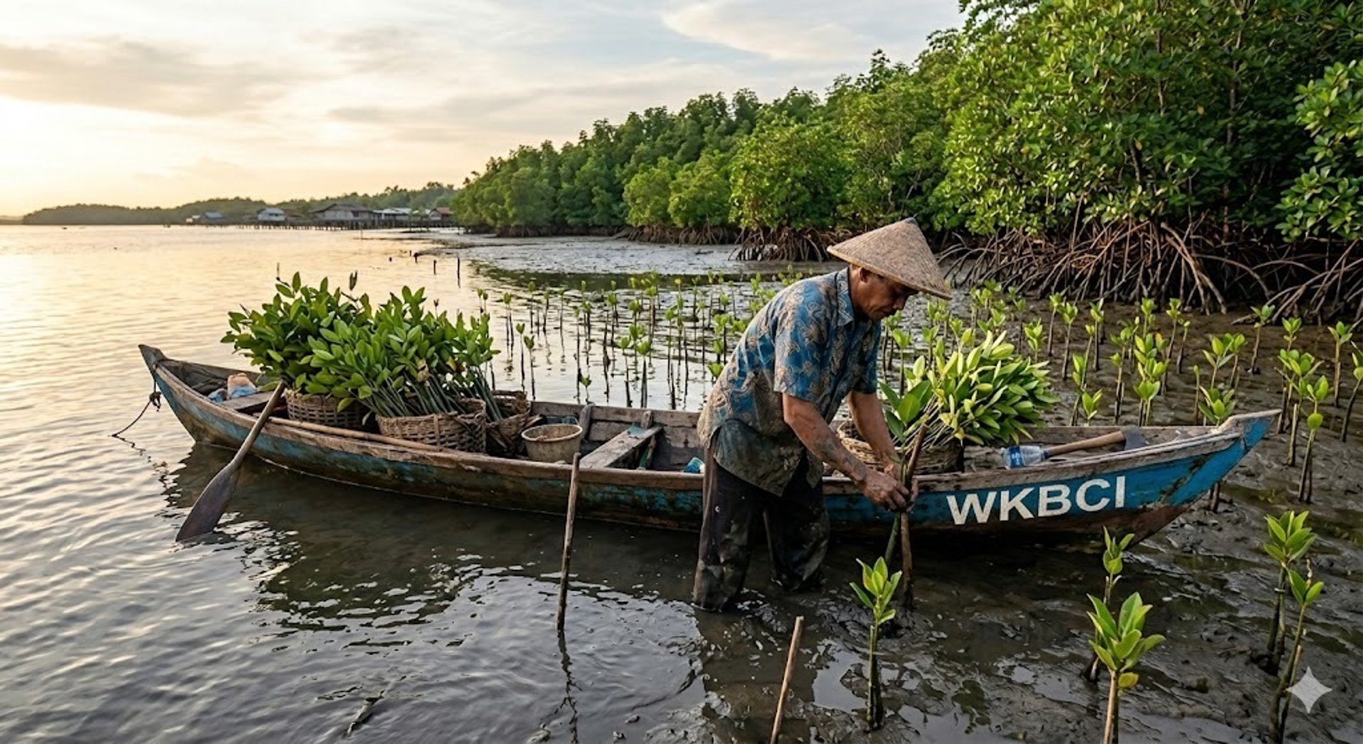
Community-Led Blue Carbon Initiative
A community-owned blue carbon developer in Ketapang Region, West Kalimantan, integrating rigorous scientific measurement with direct coastal sovereignty for local fishing families.
Measured from Sediment to Canopy
We measure carbon stocks down to the sediment layer, providing international carbon-market stakeholders with verifiable climate outcomes backed by community-led MRV protocols.
150t+
12,000ha
100%
Soil organic carbon per hectare, verified through rigorous sediment-layer core sampling.
Protected coastal landscape under active community stewardship and scientific monitoring.
Community-patrolled nursery zones ensuring long-term ecosystem viability and food security.
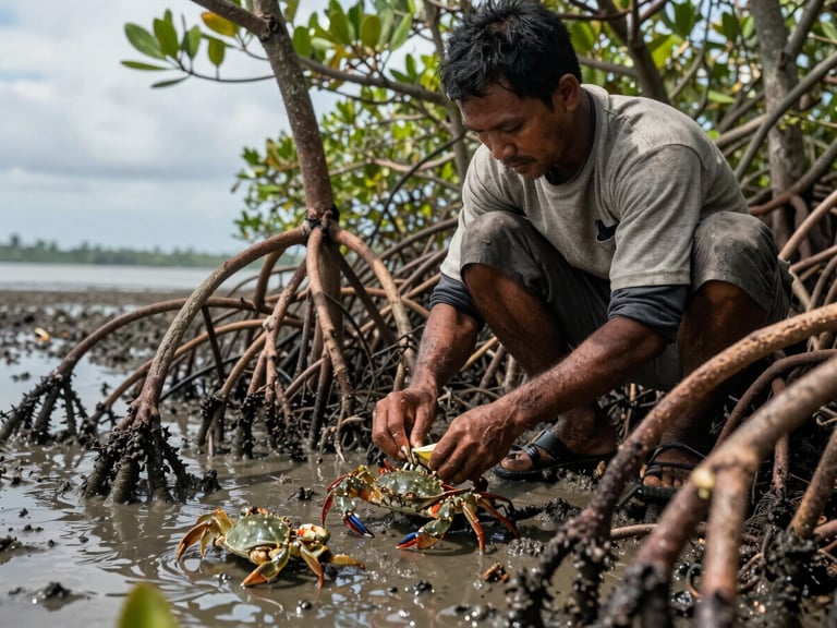

Fisheries-Integrated Restoration
By linking mangrove restoration directly with sustainable coastal fisheries, we secure local food sovereignty. Healthy forests yield richer crab catches, creating a self-sustaining cycle of conservation and economic resilience.
WKBCI serves as a collaborative platform connecting local communities, government agencies, academic institutions, and private-sector stakeholders.
Invest in Coastal Sovereignty
Partner with WKBCI to secure high-integrity blue carbon assets. Our verified landscape approach delivers measurable, long-term climate, biodiversity, and socioeconomic outcomes.